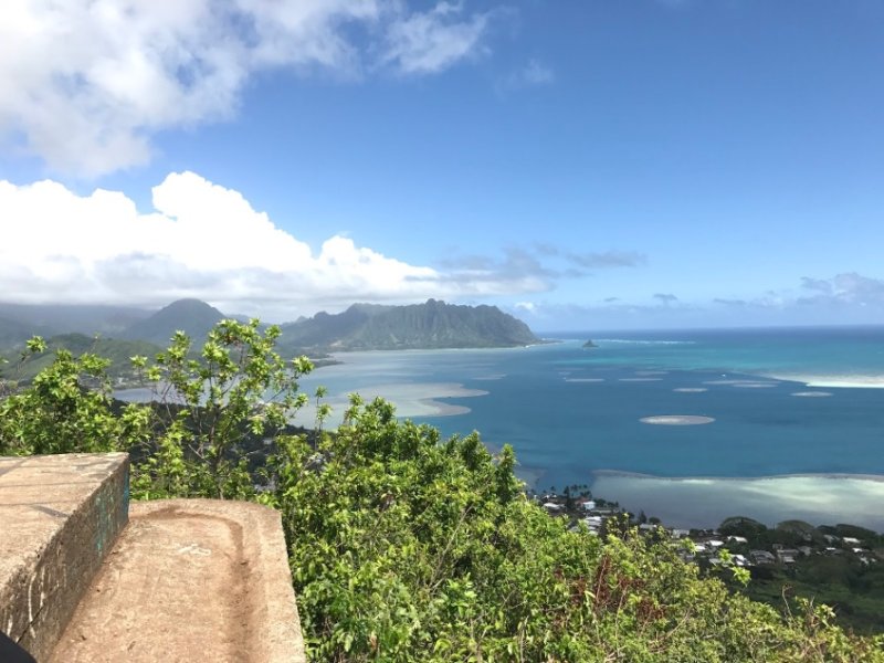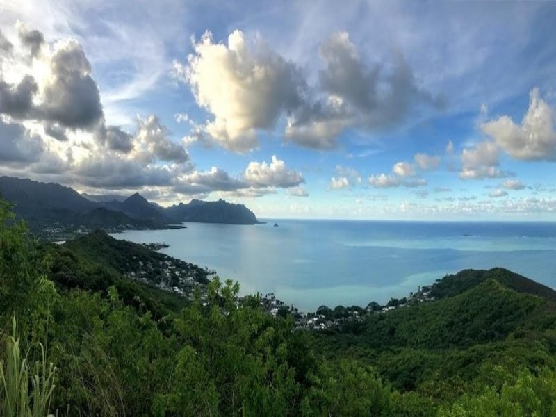
Highlights of the Hike: The final stretch of the trail features a 80 degree view atop a bunker of Kaneohe Bay, extending from Kailua all the way to Chinaman’s Hat.The teal blue hues of the ocean meet the Ko’olau Mountain Range at this very special viewpoint.
Address: Kahekili Hwy, Kaneohe, Oahu, Hawaii.
The trailhead entrance is located along the Kahekili Hwy, on the Makai side of the Highway across from Valley of the Temples. Walk along the guardrail, heading south towards Kailua for about 5 minutes until you reach the trailhead opening.
Hours: Sunrise to Sunset
Map of Location: Pu‘u Ma‘eli‘eli Pillbox Hike | Google Maps
Best Times to Hike: Reach the bunker at first light for a front row seat to see the sunrise. If staying on Hawaiian time is more your speed, head up around late afternoon and cool down at the top. Trees provide shade along the entire hike, making this a comfortable hike for dogs as well. Give yourself enough time to enjoy the view, and to make it down safely before the sunsets, as it can be dangerous shuffling down the steep hills. Please plan ahead, and check the weather for potencial heavy rain.
Parking: Street parking along Hui Iwa Street.
Bathrooms / Water: No facilities.
Safety / Skill Level: This hike requires an intermediate to basic skill level. Multiple steep inclines make this 2.1 mile round trip hike a fast trek up to the summit, but be prepared to pull yourself up a short section with ropes, if necessary. The hike is easy to follow along a well groomed path, and there are plenty of rest stops along the way with sneak peaks of the ocean in the distance. Hiking or non-slip shoes are helpful as you make your way back down the trail. Enjoy the journey!